Let your Blueye ROV run autonomously by using Mission Planning
Mission planning empowers the Blueye ROV to perform underwater tasks with greater precision, significantly reducing the potential for human error. This is valuable in many situations where high accuracy is essential. For search and recovery operations, mission planning enables the ROV to systematically inspect the seabed, ensuring that every part of the search area has been covered. If you have coordinates you wish to reach, you can easily add the point of interest to the Mission Planner and instruct the ROV to drive to the desired location autonomously.
The Blueye GPS
The new Blueye GPS is an invaluable tool for streamlining mission planning, making it easier for operators to tag and navigate points of interest with precision. By positioning the ROV at the surface and obtaining a GPS fix within seconds, operators can easily mark locations for future reference. This functionality not only saves time but also enhances the accuracy of missions. Moreover, the Blueye App allows users to set multiple waypoints, enabling the ROV to navigate semi-autonomously to specific locations. This feature proves especially useful for systematic surveys and repeated inspections, ensuring consistent, reliable results for ongoing research or monitoring tasks.

With the Blueye GPS you will get the live position of the ROV when it is at the surface, and with the mission planning feature, you can easily plan and navigate to specific locations.
Enhancing the precision of underwater missions
The Mission Planner makes it easier to examine specific underwater areas repeatedly. This is especially beneficial in marine research, for example. Researchers can pre-plan a mission to measure water quality at set depths, combining it with the Aqua TROLL 500, or document changes to a coral reef over time. Instructing the ROV with the same set of coordinates for each mission will also strengthen your test results.

Streamline the ROV operation with a pre-planned schedule
Using the mission planner module also increases the efficiency of the dive. Routine inspections can be done more productively by reducing time spent on manual control. Harbor inspections, or areas on the seabed with multiple fixed locations of interest, are missions that can benefit from utilizing a pre-planned diving route.
Using the mission planning function can also help discover specific underwater objectives like shipwrecks or submarine cables more effectively. By knowing the point of interest (POI) and the depth of the target, the ROV can reach the target without any manual interruption.

Exploring the capabilities of the Mission Planning Module
The mission planner function allows you to create a list of instructions that will be executed automatically on the ROV. With this feature, the ROV can:
- Navigate to a waypoint
- Dive to set depths
- Hold its’ position
- Capture photos at specific distances or time intervals
- Start and stop recordings
To make a mission plan, you can simply use the Blueye app and add instructions in the navigation center. This can be done either from your office weeks before the dive or directly on the boat just before deploying the ROV into the water. The plan is automatically saved within the Blueye app and can be exported to your local device for further sharing or future operations.
Below is an example of a mission plan in the Blueye app. The instructions can be easily added, deleted, relocated, and edited.
The screenshot below displays a pre-planned route where the ROV navigates to different POIs set in the instruction plan. You can also vary the depth at each point, take pictures, or set one altitude during the entire dive.

When pressing “start mission” in the navigation tab, you can observe the ROV navigating from one POI to another on the map in real time.

It is also worth mentioning that if the ROV cannot execute the pre-planned instructions due to encountering an obstacle or the tether becoming too tight, it will enter fail-safe mode. Then, you can easily adjust the plan or push the resume button to repeat the operation.
The Mission Planner is also available through the Blueye Observer app, enabling you to use a second device to follow the map while the operator device follows the live camera feed.
Mission planning for Blueye's ROVs
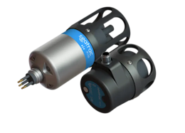
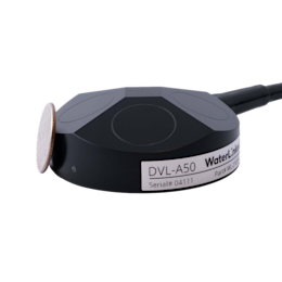
The Mission Planner module applies to all of our ROVs: the Blueye Pioneer, Blueye X1 and Blueye X3. However, being able to navigate to waypoints requires a positioning system such as the DVL A50 or the SeaTrac USBL Positioning System. Without a positioning system, the ROV can still go to specific depths to record or take pictures.
Are you interested in trying out the mission planning module? Check out our support article on how to get started.


